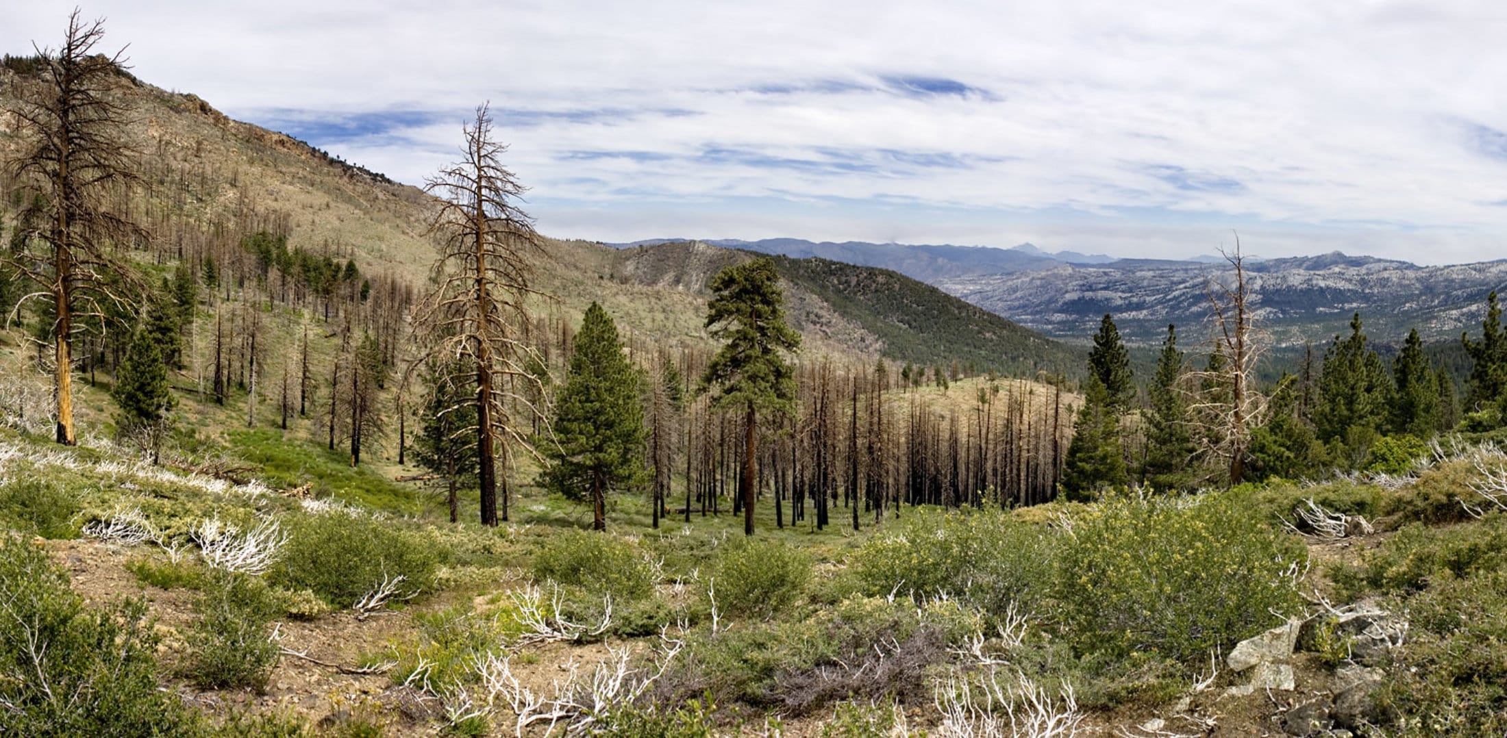
Death Valley, Sherman Pass, Sequoia & Kings Canyon
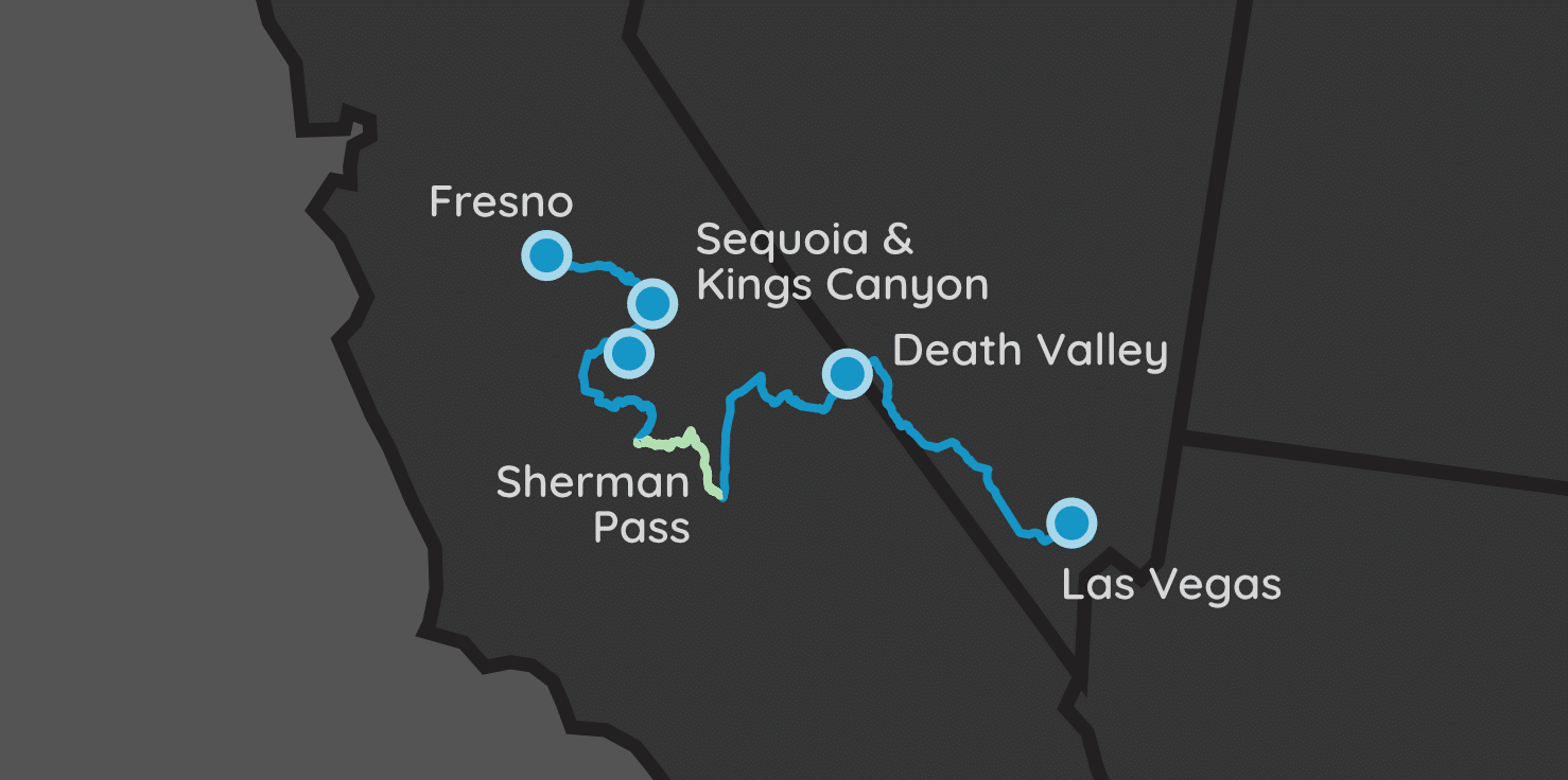
| Parks: 4 | Miles: 545 | Days: 8 | Hours: 14 |
We’ve created other road trips that either included Yosemite or Pinnacles before, but wanted to change things up for this one. Here, we visit three National Parks, with the highlight of the trip being a drive along Sherman Pass.
For the uninitiated, Sherman Pass Road is a scenic drive with lots of twists and turns with excessive grades that crosses the Sierra Nevada Mountain Range, and is the third highest paved road in California.
Itinerary Notes
This trip can be reversed, like many of our others. Fly into a central California airport, and visit Kings Canyon & Sequoia before trekking Sherman Pass on your way to visit Death Valley.
Sherman Pass Road is not for the faint of heart. It has crazy steep grades, and multiple twists and turns. The road is safe if you’re careful, and the views from it are amazing. This road is also virtually empty, so if you are looking to get away from crowds, this would be the perfect place.
Don’t forget to schedule your rental car ahead of time. Sherman Pass doesn’t have any car restrictions, except for when weather conditions close it down. The road is only open from late May or early June.
Las Vegas, NV
It’s no secret that using Vegas as an access point for our trips is one of my preferences, and this trip is no different. After the flight in, I would suggest grabbing your rental car, and diving right to the next spot instead of staying the night in Sin City. The next stop is less than 2 hours away.
Driving
The next location is 124 miles away (~2 hours).
The trip to our next night’s stay in Beatty, NV takes less than two hours. It passes Red Rock National Conservation Area, so if you have some extra hours to kill, this place is highly recommended by us for a visit.
Death Valley National Park
Beatty, NV
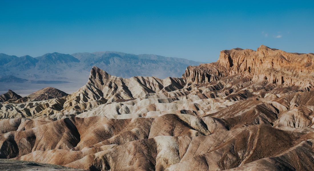
Death Valley National Park is mostly known for its extreme temperatures and elevation changes. The park features the lowest point in North America and has elevation changes that exceed 8,600 feet. This park’s complex geology offers a sight into bygone eras of lost seas, volcanoes and fault lines.
Lodging
The park can easily be accessed from the west via the California towns of Lone Pine, Ridgecrest and Olancha. You can stay on the eastern side of the park in either Beatty, NV or Shoshone, CA. We decided to choose Beatty because it was a perfect spot to both visit the National Park and was an easy trip from our flight in via Las Vegas.
Attractions
If you stay in Beatty, you’ll enter the park via the Daylight Pass Road. This road offers stunning views that seem to change at every turn. Beatty is about a 45 minutes drive to the main Visitor’s Center of the park in Furnace Creek.
From this point, access to many of the popular sights is easy. The lowest point in North America – Badwater Basin – is 17 miles south of the center. Zabriskie Point is 7 miles south of the center, and overlooks eroded badlands from a high vantage point. This is a must-see at either sunrise or sunset!
The one way loop known as the Artists Drive is another must see attraction. The amazing array of colors stemming from the oxidation of various metals on the volcanic rock is a one-of-a-kind sight. The landscape features multiple hues of colors including green, red, yellow, purple, and pink!
The best easy hike in the park is hands-down the one at Derwin Falls. This 2-mile round trip hike starts west of Panamint Springs on Route 190 and takes you past the waterfall and back in about one and a half hours.
Driving
The next location is 143 miles away (~2.5 hours).
At the end of your second day exploring Death Valley, head south towards your next stop of Pearsonville, CA. It’s a town you’ve likely never heard of before, but tomorrow it will be the start of the most epic drive of your lifetime. (How’s that for some foreshadowing?)
Sherman Pass, a Trans-Sierra Highway
Pearsonville, CA
You may be wondering to yourself, “Why are we spending a night in a random California town, just to drive a road I’ve never heard of before?”
Well, it’s because this road is not like any others.
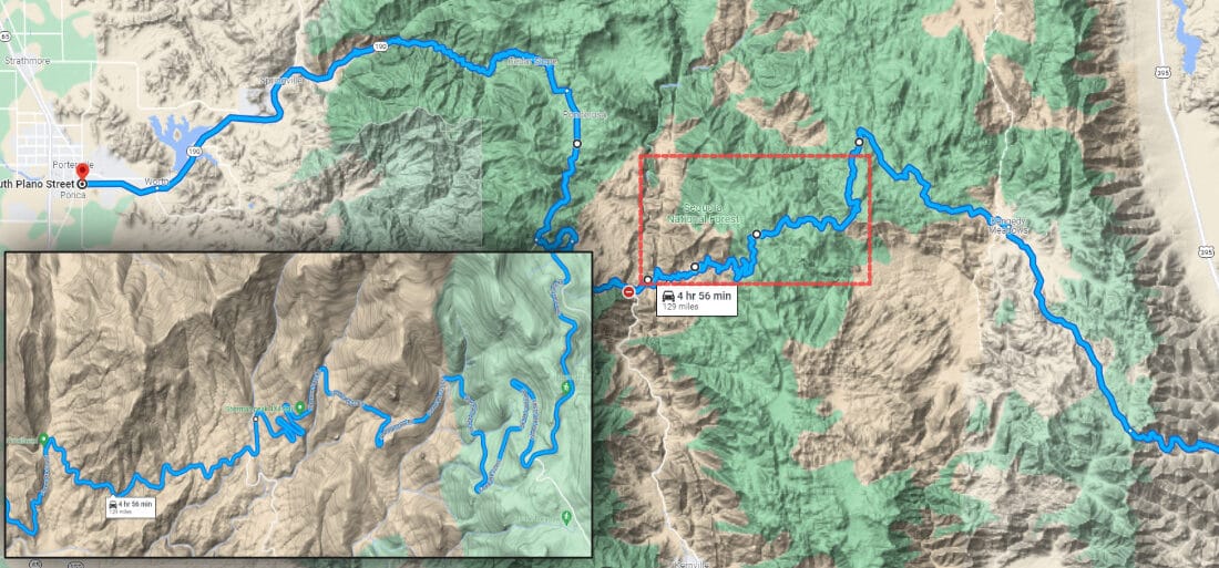
First and foremost, Sherman Pass (or state route 22S05), and subsequent offshoot the Great Western Divide Highway, will take you over 5 hours to get from one end to the other.
Second, this is a winding, difficult road to drive. But one that is also absolutely worth the effort.
The Drive
Starting in Pearsonville via Highway 395, Sherman Pass is a paved highway that crosses the southern flank of the Sierra Nevada Mountain Range.
From the east, the road starts in the Mojave Desert, then ascends onto the Kern Plateau. At the summit of Sherman Pass, visitors enjoy stunning views of the Sierra Crest and Mount Whitney, the tallest mountain in the lower 48 states. After cresting the summit, the road then descends into the Upper Kern River Canyon.
After crossing the Kern River on the Johnsondale Bridge, the road turns into Mountain Highway 99., then eventually splits into Highway M-50 that continues west, and 22S82 that heads north. Since our next stop is Sequoia, taking 22S82 is the route we want. It eventually turns into the Great Western Divide Highway, which exits the mountains in the town of Porterville.
The scenery on this road is beautiful, and the traffic is almost non-existent. Services such as fuel, food, and accommodations are very sparse, so load up beforehand before you leave.
Weather Impact
The road is only open from late May or early June, depending on snow, until the snow falls in late fall or winter.
Driving
The next location is 174 miles away (~6 hours).
This driving itinerary block accounts for the scenic drive along Sherman Pass, but also the finish of the route up to Three Rivers, CA.
Sequoia National Park
Three Rivers, CA
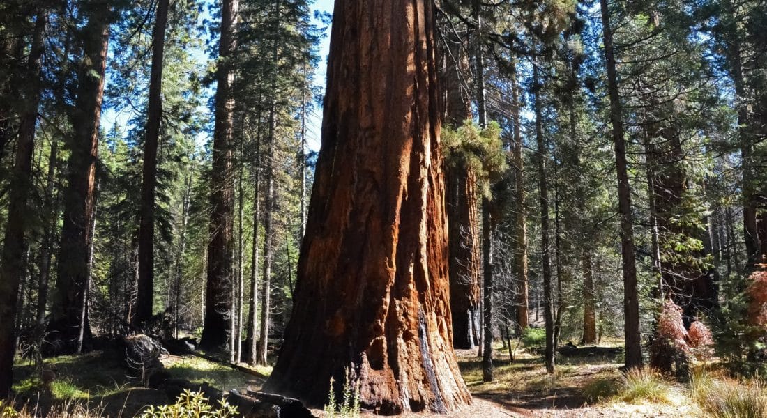
Sequoia National Park is home to some of the tallest and oldest trees on Earth. The park also has the tallest peak in the contiguous Unites States: Mount Whitney (14,494 ft)
Lodging
We decided to stay in the town of Three Rivers, CA, which only about a 7 mile (11 km) or 13-minute drive to the entrance of Sequoia through the Ash Mountain Entrance. There were plenty of Airbnb options in this area, but there are also a handful of hotels and motels in the same vicinity.
The Silver City Resort is within the park, but – again – it fills up fast, and unless you are looking many months into the future, you will have to find other accommodations.
If you still cannot find any space, consider Visalia, CA, which is about 40 minutes south from the park’s entrance.
Attractions
Many of the most famous attractions within Sequoia NP are located on the General’s Highway. Leave the top of that highway for the car ride out to the next park in a couple days and instead focus on the southern parts of the park.
The Giant Forest Museum and Moro Rock are a couple more must-stops just inside this visitor’s center.
As for hiking in Sequoia NP, the Big Trees Loop (1.2 miles round trip) near the Museum and the Cold Springs Nature Trail are two easy trails that the whole family can enjoy. The Marble Fork Trail (7.4 miles round trip) starts at the Potwisha Campground and winds up a strenuous trail to view the amazing Marble Falls.
Driving
The next location is 74 miles away (~2.25 hours).
Sequoia and Kings Canyon National Parks are connected and even share one entrance fee. This allows us to explore both parks via this one stop. Use the General’s Highway to get from Sequoia to Kings Canyon. It takes a little over 2 hours (63 miles) to get from one park to the other. We suggest spending a full day on this road and exploring its numerous stops and attractions.
The full drive up to Yosemite will take about 3 hours if you didn’t stop anywhere, so keep this in mind when you are making stops at Kings Canyon.
Kings Canyon National Park
Squaw Valley, CA
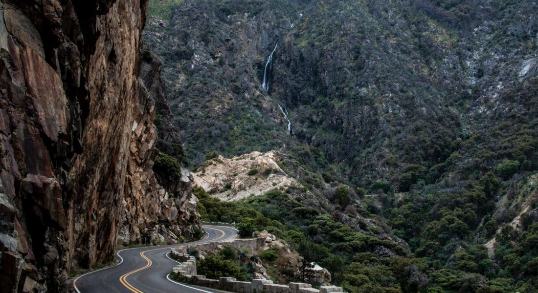
Kings Canyon is one of the lesser known National Parks in the area and often gets dwarfed by those visiting Yosemite and Sequoia. Thankfully, Kings Canyon and Sequoia are so close, that even the entrance fee covers both parks!
Lodging
Stay in Pinehurst, Squaw Valley, or Miramonte, all of which have an impressive amount of vacation rentals. If you are looking for lodging within the confines of the park, the Wuksachi and Montecito-Sequoia Lodges are beautiful, but fill up very quickly. There are others in the area as well, like the Cedar Grove Lodge and the Grant Grove Cabins, so there are plenty of options within the park if you find yourself not finding any availability.
Attractions
In my opinion, the best part of Kings Canyon was the Generals Highway. We spent most of our days here towards the top of the highway exploring since this is the route we used to travel up from Sequoia a day earlier.
The best entrance to Kings Canyon is the Big Stump Entrance, which is right next to Pinehurst. The 1,700 year old General Grant tree (second-largest by volume in the world) and Kings Canyon Visitor Center is also immediately following this entrance.
After entering, head north on route 180 and snake through the 35-mile long Kings Canyon Scenic Byway. Be sure to stop at the Canyon view, about one mile east of the Cedar Grove Village.
As for some great trails to hike, the General Grant Tree Trail, North Grove Loop, and Roaring River Falls Trails are can’t miss easy trails for the whole family. If you are looking for more moderate trails, consider hiking the Mist Falls Trail (8 miles round trip), the trail up to Buena Vista Peak (4 miles round trip) and the Big Baldy Trail (4.4 miles round trip).
Driving
The next location is 30 miles away (~.5 hours).
After all the driving in this trip, I wanted to shorten the final leg for the way home. We chose to fly home out of Fresno International.
Fresno, CA
I decided to try the Fresno International Airport, which is much closer (30 miles) to Kings Canyon than say San Jose (184 miles) or San Francisco (214 miles).
The tradeoff is that Fresno is a much smaller airport than those two. You’ll likely end up having a layover in either Las Vegas or San Francisco before making it back home. Extra layovers and less flight options are the downsides of using a smaller airport such as Fresno.
