Hiking the Sliding Sands Trail in Haleakala National Park
Haleakala National Park is located on the Hawaiian island of Maui. The park is home to the massive, dormant volcano of the same name, which is also unsurprisingly the highest point on the island. Aside from the volcano’s cinder deserts of the volcano’s summit, the park also boasts lush rainforests and a diverse array of other landscapes. A trip to see Haleakala National Park is really a once-in-a-lifetime type of event!
One of the most popular trails in the Haleakala National Park is the Sliding Sands Trail, known by the locals as Keonehe’ehe’e Trail. Its path gives visitors the opportunity to hike through the unique and otherworldly landscapes of the volcano’s summit and crater area.
The first thing that will stand out is how enormous the entire crater actually is. Think of how big you expect it to be, and triple it. It’s massive.
Getting to the Sliding Sands Trail
Sliding Sands Trail Trailhead & Parking Lot Address: Haleakala Visitors Center, Haleakala Hwy, Kula, HI 96790
The GPS Coordinates to the trailhead are 20.714504, -156.250715.
Getting to the trailhead of the Sliding Sands Trail is super easy since it’s right next to the Haleakala Visitors Center. The visitor center parking lot is pretty big, so you shouldn’t have too much finding a spot unless you’re going midday on a weekend during summer (seriously… don’t do that).
You’ll need a reservation to enter the park if you want to get a start on your hike early. Since 2020, the National Park Service has implemented a timed entry system at Haleakala National Park for anyone intending to see the sunrise (before 7am). So, even if you’re hiking, you’ll still need a reservation.
There are restrooms without water at the visitor’s center, but nowhere else on this trail.
The Sliding Sands Trail
| Hiking Distance | 11 miles (18 km) |
| Hiking Duration | 8-9 hours |
| Route Type | Point to Point |
| Difficulty Level | Very Difficult |
| Elevation | 9,760 ft (at trailhead) |
| Elevation Climb | 3,054 feet (931 m) |
| Trail Type | Dirt |
| Wheelchair Accessible | No |
| Pets Allowed | No |
| Fees | Free, but Haleakala NP has an entrance fee |
The full Sliding Sands Trail is a very strenuous 11-mile point-to-point hike that starts near the entrance to the Haleakala Visitors Center and ends at the Halemau’u Trailhead, about a 6-mile drive from where you started.
This hiking trail is extremely difficult, and in fact many seasoned hikers actually backpack into the crater with tents and spend the night. On this sandy trail, you’ll reach the very edge of the enormous crater, and then turn north on the Halemau’u Trail about halfway in. The Sliding Sands Trail actually continues on further through the crater, but in order to get back to civilization, you’ll need to use the Halemau’u Trail.
This long and strenuous hike is only for seasoned and experienced hikers. However, for a good half-day hike for the rest of us, I suggest cutting it short and turning around only a few miles in. Don’t get me wrong… this is still a hard hike, but just not as difficult as the full one. And don’t worry: you’ll still get some of the most amazing views you’ve ever seen!
The Shortened Trail
| Hiking Distance | 4 miles (6.5 km) |
| Hiking Duration | 2-3 hours |
| Route Type | Out and Back |
| Difficulty Level | Difficult |
| Elevations | 9,760 ft (at trailhead), 8,559 ft (at turnaround) |
| Elevation Climb | 1,201 feet (366 m) |
| Trail Type | Dirt |
| Wheelchair Accessible | No |
| Pets Allowed | No |
| Fees | Free, but Haleakala NP has an entrance fee |
For the shortened trail, we still start out at the Haleakala Visitors Center. We will follow the main Sliding Sands (Keoneheʻeheʻe) Trail signs, but only continue down for about 2 miles before turning around.
Normally, here is where we’d recommend hiking up to the Ka Lu’u o ka O’o Cinder Cone, but it has been closed since 2021 due to damage to the cone itself. However, I still recommend you make it down into the crater to the cinder code’s trailhead before turning around. That would put your total mileage into the crater at almost exactly 2 miles, making your full out-and-back mileage 4 miles.
The shortened version of the Sliding Sands Trail is all downhill until you turn around, at which point it becomes all uphill. The climb in and out are over 1,200 feet of elevation change, so this trail is by no means “easy”.
The map above shows the full trail, but also the trailhead (A) and the suggested turnaround spot (B). At the turnaround spot, you’ll see a clearly marked sign saying the trail to the cinder cone is closed and that there will be fines for any trespassers.
What You Can Expect to See on Sliding Sands Trail
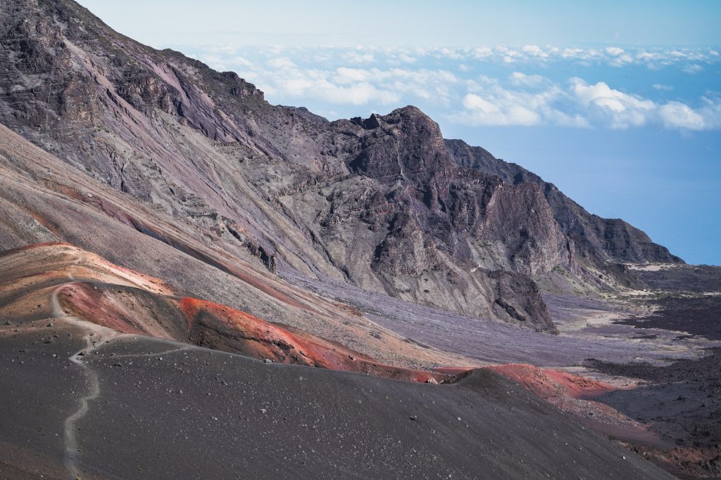
As you begin down Sliding Sands Trail, you will be greeted with the stunning panoramic views of the volcano’s summit. The trail quickly descends into the crater, where you will be surrounded by otherworldly landscapes of cinder cones, volcanic rock, and colorful volcanic ash.
After about a mile, stop at Na’ena’e Overlook for long views across the crater floor to the Kaupo Gap.
As you hike deeper into the crater, you will also be able to see the park’s famous ahinahina, or silverswords, a plant that is unique to the volcano and is only found in a few other places in the world. You’ll get to see the silverswords near the end of the shortened hike as well!
Sliding Sands Weather
The weather inside the park varies depending on the season, but it is generally cold and windy at the summit as it is 10,000 ft above sea level. Regardless of the season, be sure to bring warm clothing in layers and drink lots of water. Hiking shoes or boots are a must. There is no shade on this trail whatsoever.
During the winter months, the park can be cold and wet. It is also important to be aware that the park is located at a high elevation, so altitude sickness is a concern for some visitors.
