Hiking the Fairyland Loop Trail in Bryce Canyon
Bryce Canyon National Park is located in southern Utah and is known for its colorful hoodoos, which are spire-shaped rock formations. The park is also home to a variety of hiking trails, including the Fairyland Loop Trail. This 8 mile (13 km) loop trail offers a unique perspective of the park’s hoodoos and other geologic features, making it a must-see for any park goer.
Getting to the Fairyland Loop Trail
Here are the GPS Coordinates to the parking lot of the trailhead: 37.649472, -112.147552 (Google Maps Link).
To reach the trailhead, visitors can take Highway 63 to Bryce Canyon National Park’s north entrance. To get here, go past the Bryce Canyon Sign about 0.3 miles, then turn left on Fairy Spur Road. If you pass the Bryce Canyon Visitor Center, you’ve gone too far. The parking area is one mile down that road at the end of it. All in all, the trailhead is located about 1.2 miles from the entrance and only steps from Fairyland Point parking area.
Remember, like with many parking areas in popular parks, the lot can fill up quickly during peak seasons, so it’ll be best to arrive early.
If that parking lot is full, you can try the trail’s secondary access at Sunrise Point, which is about 3 miles south of Fairyland Point in the town of Bryce Canyon City.
Alternatively, visitors can park in the city of Bryce and take the park’s shuttle service to Fairyland Point instead. In fact, this may be best. The park gets very crowded come May, June, and July. Bryce Canyon National Park is a fairly small one, so there isn’t much room inside once the visitors start arriving for their summer vacations.
The Trail
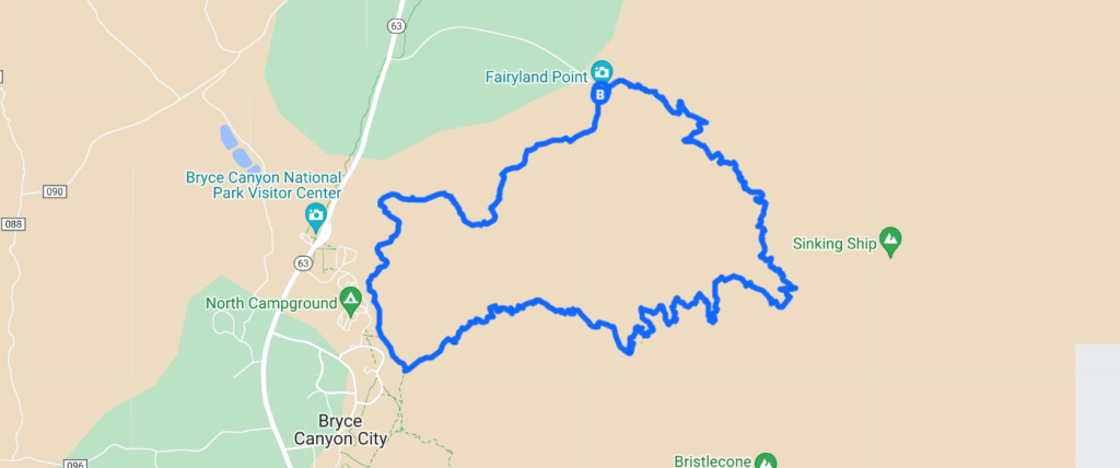
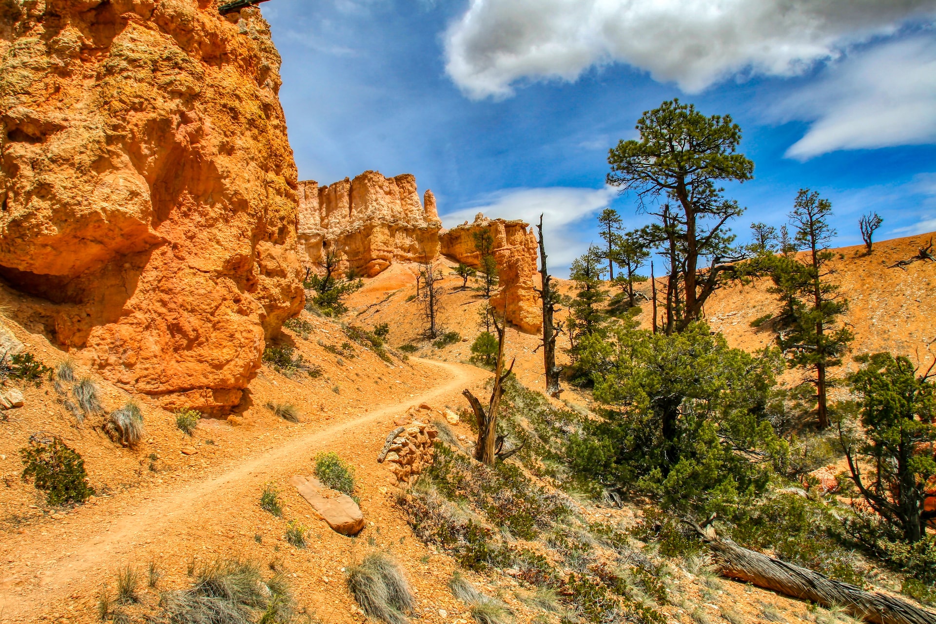
The Fairyland Loop Trail is considered a moderate hike due to its length and elevation gain. The trail takes hikers through a variety of landscapes, including hoodoos, canyons, and sparse forests. Along the way, hikers will see a number of unique rock formations, including the Chinese Wall, Fairyland Canyon and the Tower Bridge. This particular trail also offers stunning views of the park’s natural amphitheaters and natural bridges.
I honestly feel the Fairyland Loop Trail has more views of hoodoos than any other trail in the park. This is my favorite hike in the park as well.
| Hiking Distance | 8 mile (13 km) Loop |
| Hiking Duration | 4-5 hours |
| Difficulty Level | Moderate |
| Elevation Climb | 1,545 feet (470 m) |
| Trail Type | Dirt with obstacles. |
| Pets Allowed | No |
| Fees | Free to hike, but Bryce Canyon NP charges an entrance fee. |
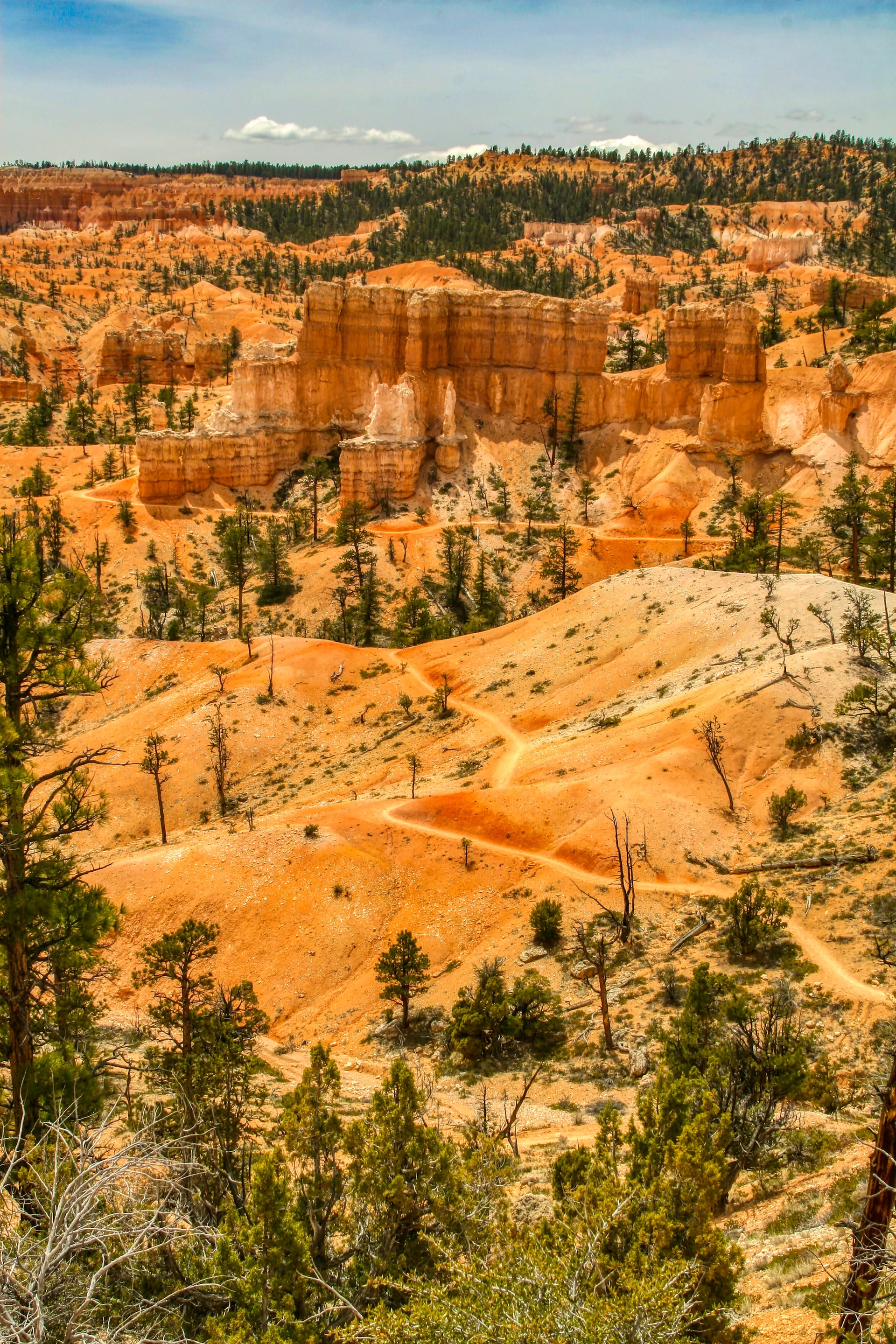
The Fairyland Loop Trail begins right at the parking area.
You can choose to go either direction along the Fairyland Loop Trail, but in my opinion, clockwise is the best direction to go. You’ll end with a stretch of path that is all uphill, but it is gradual and doesn’t feel as bad as it sounds. It should also be noted that this entire trail is a combination of two different trails: The Fairyland Loop Trail and the Rim Trail… both combine to make the full loop. By taking the Fairyland Loop clockwise, you’ll begin on the Fairyland Loop Trail before finishing on the Rim Trail along the canyon rim.
As for how difficult the hike is, there is plenty of elevation change along the trail, but it’s gradual ascending and descending switchbacks make it way easier on your legs than you’d think.
Staying Safe on the Trail
The Park Service recommends a wide brimmed hat (for sun protection) and carrying plenty of water if you’re hiking at Bryce Canyon in the summer. You should bring 1 quart for every 2-3 hours of hiking per person.
Weather on the Trail
Bryce Canyon National Park has a high desert climate, which means that temperatures can vary greatly between day and night. During the summer, daytime temperatures can reach over 90 F with lows in the 40s and 50s. Spring and fall are the best times to visit the park, as temperatures are milder, and the park’s hoodoos and other rock formations are at their most colorful.
In the winter, the park is covered in snow, with the trail sometimes accumulating ice and 2 feet of snow in places! However, Bryce Canyon National Park is open during winter, so bring snowshoes, hiking poles and possibly crampons if you intend to hike here in the winter.
Other Nearby Attractions
The Fairyland Loop Trailhead in Bryce Canyon National Park offers access to several other trails and points of interest in the park, including:
- Navajo Loop Trail: This popular trail takes you down into the main amphitheater of Bryce Canyon and offers views of some of the park’s most famous hoodoos, including Thor’s Hammer, the Three Gossips, and the Tower Bridge.
- Peekaboo Loop Trail: This moderately strenuous trail takes you down into the Bryce Canyon backcountry, where you’ll get to see some of the park’s most remote hoodoos and formations.
- Rim Trail: This easy trail takes you along the rim of the Bryce Canyon amphitheater and offers breathtaking views of the hoodoos and formations below.
- Sunrise Point: This popular viewpoint offers panoramic views of the Bryce Canyon amphitheater and is a great place to see the sun rise over the hoodoos.
- Sunset Point: Similar to Sunrise Point, Sunset Point offers stunning views of the park and is a popular spot to watch the sun set over the hoodoos.
