The Swamp Canyon Trail & Overlook in Bryce Canyon
Bryce Canyon National Park is one of the smallest national parks in Utah, but it is a favorite of just about anyone who visits. The park is known for its unique hoodoos, which are tall, spire-shaped rock formations. One of the must-see trails in the park is the Swamp Canyon Trail & Overlook, which is one of the lesser visited parts of Bryce Canyon NP.
Getting to the Swamp Canyon Overlook & Trailhead
The GPS coordinates of the parking area are 37.587824, -112.213147 (Google Maps Link).
To reach the trail head and parking lot, take Utah Highway 63 scenic drive into the park for about 5 miles (10 minutes) past the only Bryce Canyon entrance. The paved parking lot will be on the left side of the park road. The parking lot is not big – maybe room for 10 vehicles or so – and can fill up very quickly during peak season. As always, it is best to arrive early in the morning to ensure you get a parking spot and avoid the crowds on the trail.
The Swamp Trail Overlook is only steps in front of the parking lot.
The Swamp Canyon Overlook
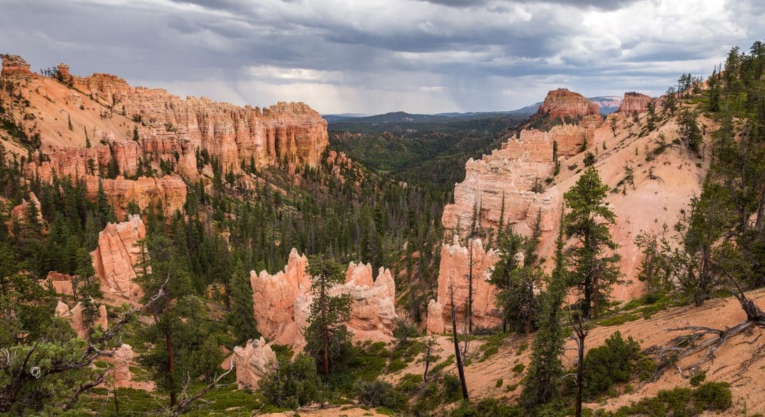
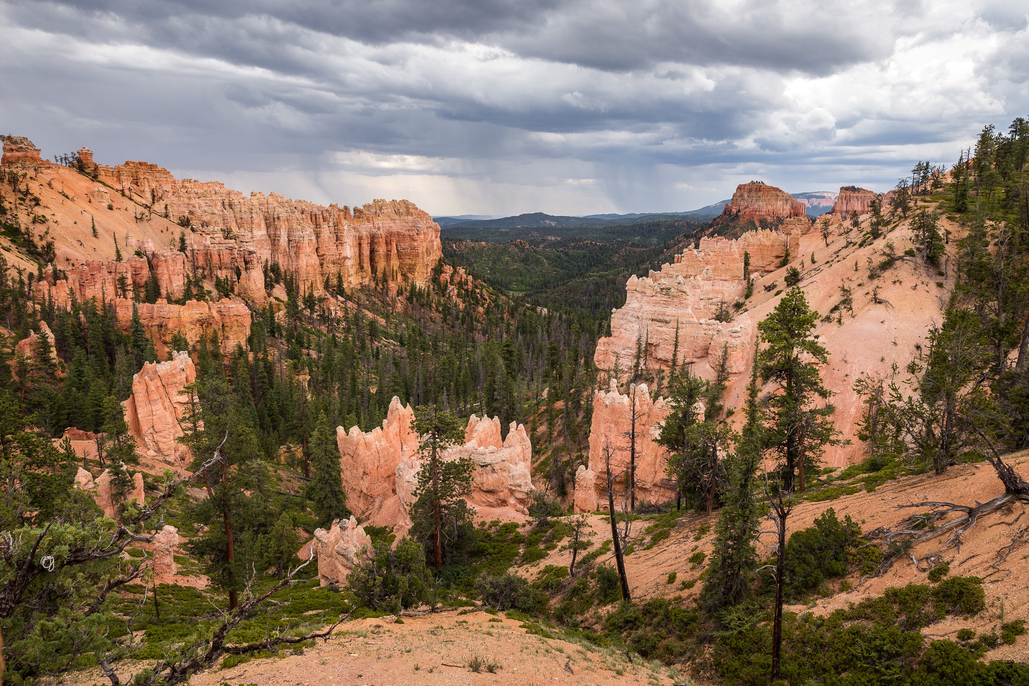
From the overlook, you peer into Swamp Canyon, which is one of the wettest spots in all of Bryce Canyon National Park. Swamp Canyon appears relatively small and sheltered from your viewpoint on the overlook, with the canyon bounded on both sides by fins and hoodoos.
The Swamp Canyon Trail
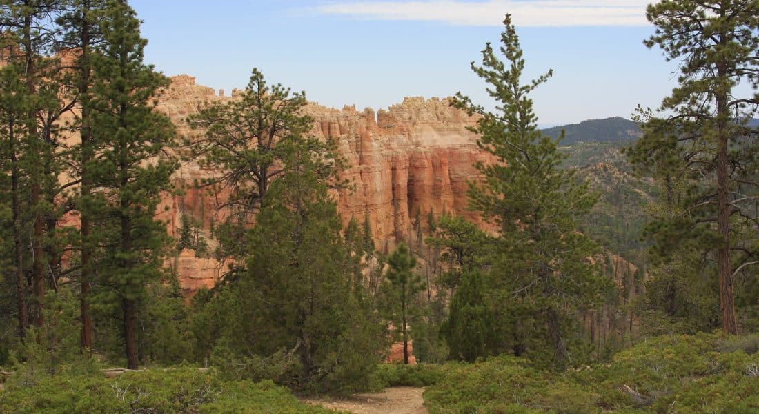
The Swamp Canyon Loop Trail is a moderate difficulty looping hike that should be doable for most skill levels. The trail is well-maintained and easy to follow, although the almost 900 feet of elevation change can make it difficult for some.
Expect this trail to be much less crowded than other popular hikes in the park like Queen’s Garden or Sunrise Point.
On the left side of the parking lot will be the trail’s entrance point. The sign will read “Sheep Creek and Swamp Canyon Connecting Trail“. Less than a mile down that trail will be a junction. The National Park Service suggests going clockwise (left at the junction to Sheep Canyon Trail), while just about every other visitor prefers counterclockwise (right) along Swamp Canyon Trail.
Since it is a loop, I guess it really doesn’t matter, but if there is a chance you will not make the full loop, definitely go counterclockwise. This way will ensure you get to see some of the best views in this direction, as well as no steep descents.
| Hiking Distance | 4.5 miles (7 km) |
| Hiking Duration | 2-3 hours |
| Route Type | Loop |
| Difficulty Level | Moderate |
| Elevation Climb | 892 feet (272 m) |
| Trail Type | Dirt |
| Wheelchair Accessible | No |
| Pets Allowed | No |
| Fees | Free to hike, but Bryce Canyon NP charges an entrance fee. |
Heading right at the junction, you’ll gradually descend into Swamp Canyon via switchbacks. The forest is sparse here, allowing for great views of the canyon and the hoodoos. You’ll eventually connect with the Under The Rim Trail. This part of the path is relatively flat and connects the Swamp Canyon trail to the Sheep Canyon trail. This is about halfway. You will see a variety of rock formations on this trail, including the famous hoodoos that Bryce is known for, as well as its green forests juxtaposed against the red sandstone of the canyon. In fact, I’d say about 30% of the trail is wooded.
As you turn onto Sheep Creek trail, you’ll gradually ascend over the canyon rim. This part of the trail is lined with groves of ponderosa pines. Eventually, you’ll come across the original junction, at which point the overlook starting point will be just above you.
If you decided to stay on the Under The Rim Trail, which eventually ends miles away at the popular Bryce Point.
Seasons in Bryce Canyon
Summers in Bryce can get quite hot, as deserts usually do in Utah. However, parts of Bryce Canyon have a forest canopy that helps keep the canyon valley cool. Bring lots of water, bug repellant, and take frequent rests in hot temperatures.
Winter brings snow and ice, very little crowds, and typically no road closures. The Swamp Canyon trail will get muddy and icy when it snows, so be prepared with good boots and hiking poles. The temperatures can also get downright blustery here in the winter as well. Wind chills can stretch into the negatives, and highs barely reach above freezing in the winter.
The park is least crowded in the shoulder seasons of spring and fall. Our data shows the best months to visit Bryce Canyon National Park are September, June, May & August.
Nearby Trails
In addition to the Swamp Canyon Trail, there are several other trails and points of significance nearby. The Navajo Loop Trail is another popular trail that takes you through the heart of the hoodoos and ends at the Sunset Point. The Peekaboo Loop Trail is a longer hike that takes you through the backcountry of the park, offering even more stunning views of the hoodoos.
Another nearby point of interest is the Bryce Amphitheater view, which is a large, horseshoe-shaped canyon filled with hoodoos. The Amphitheater can be accessed via the Rim Trail, which is a paved trail that follows the rim of the canyon and offers breathtaking views of the hoodoos below.
