Finding Your Nearest National Park
Which National Park is closest to me?
It’s a question that’s asked countless times as families are beginning their vacation planning for the upcoming summer. Hiking, kayaking, backpacking, sightseeing… any or all of those are on the table. Last year, there were over 92 million visits to the 63 parks within our National Park system.
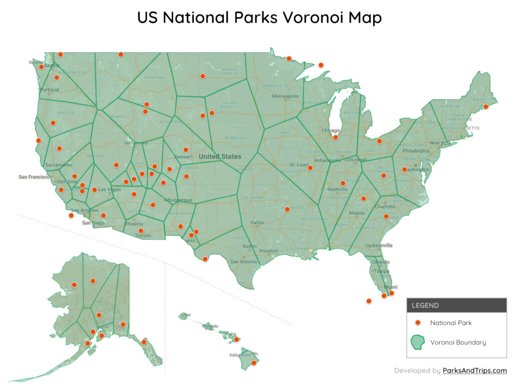
We built this map using only the US parks that have been officially designated as a ‘National Park’. The National Park Service (NPS) manages more than 290 more Battlefield Parks, Monuments, Recreation Areas, Seashores, etc. that are not shown on this map.
Map Notes
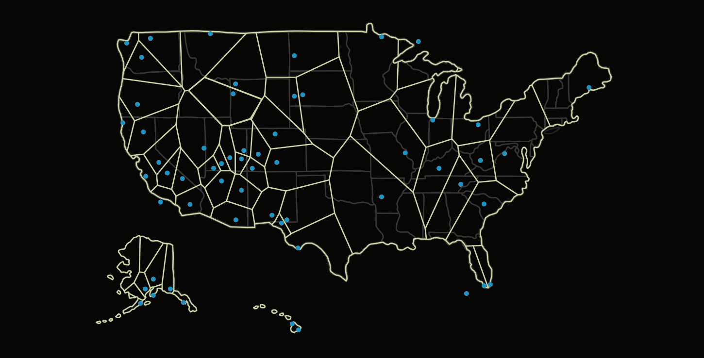
- This is called a Voronoi diagram, which is a partition of a plane (in this case… a map) into regions close to each of a given set of objects (e.g. National Parks).
- We did not use driving times to build the boundaries. The map was built using “as the crow flies”, or straight-line calculations.
- Due to using the Mercator projection, all areas are not at the same scale. However, in the interactive map below, we do list the actual square miles each area covers to help combat this.
- I would love to eventually see the populations of each area here, but I could not find a way to combine the US census data into this map. If anyone has any ideas, contact me.
- National Parks are not confined to a singular point, but instead a wide and craggy shaped area of land. Some of our national parks are simply massive, which causes a bit of a problem when building a map like this. Voronoi maps require that we build the regions around a singular point, so we chose the latitude & longitude that Google places each park at as our center.

A good example of where this becomes a problem is the Grand Canyon. The Grand Canyon is a very wide park and is inside a very crowded area of the US with 7 other park regions that border it. While Page, AZ is within Bryce Canyon’s “area”, it is technically much closer to the very northeastern tip of the Grand Canyon.- This is also an issue where two National Parks are connected, like Sequoia/Kings Canyon and Yellowstone/Grand Teton. The border between each of those two sets of parks is more-or-less arbitrary.
- The map was developed locally with this Github project, then transferred to Google MyMaps.
- A full screen version of the map can be found here.
National Park Voronoi Statistics
The National Park with the largest Voronoi area is the much maligned Hot Springs in Arkansas with 212 million acres, or almost 86 million hectares.
| Park | State | Acres | Hectares |
|---|---|---|---|
| Hot Springs National Park | AR | 212,300,160 | 85,915,221 |
| Badlands National Park | SD | 96,122,880 | 38,899,728 |
| Gateway Arch National Park | MO | 95,859,200 | 38,793,020 |
| Kobuk Valley National Park | AK | 93,382,400 | 37,790,690 |
| Shenandoah National Park | VA | 87,431,680 | 35,382,508 |
The National Park with the smallest Voronoi area is the Haleakala National Park in Hawaii with only 2 million acres (837k hectares). The smallest area within the lower 48 states is Canyonlands in Utah with 5.2 million acres (2.1 million hectares).
| Park | State | Acres | Hectares |
|---|---|---|---|
| Haleakala National Park | HI | 2,069,760 | 837,606 |
| Hawaii Volcanoes National Park | HI | 2,491,520 | 1,008,287 |
| Canyonlands National Park | UT | 5,175,680 | 2,094,533 |
| Bryce Canyon National Park | UT | 5,805,440 | 2,349,389 |
| Zion National Park | UT | 5,921,280 | 2,396,268 |
