Visiting the Bixby Bridge in Big Sur, CA
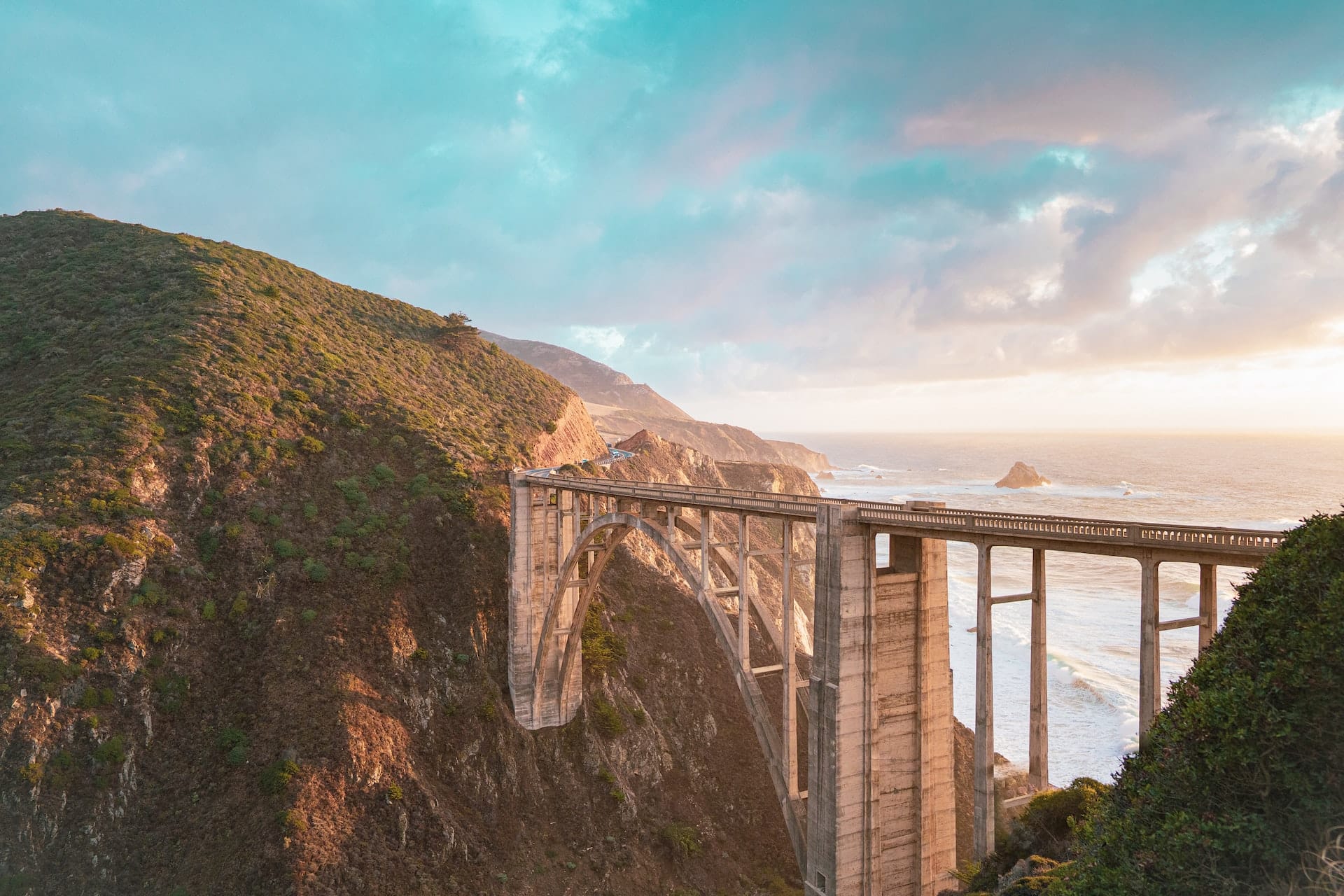
The Bixby Bridge, also known as Bixby Canyon Bridge or the Bixby Creek Bridge, is one of the most photographed bridges in California. It is very well known for its spectacular views of the Pacific Ocean and the rugged coastline of Big Sur in Monterey County. It is such an iconic bridge that it has often used as a backdrop for TV shows such as Big Little Lies on HBO.
The Bixby Creek Bridge is a single-span concrete arch bridge located in Big Sur, California that spans where the Bixby Creek exits into the Pacific Ocean. The historic bridge was built in 1932, and was designed by the engineering firm of Joseph Strauss, Irving Morrow, and Charles Ellis. The Bixby Bridge is an example of early 20th century engineering, and is widely considered to be a significant piece of California’s transportation history due to its Art Deco style. This bridge is 714 ft (218 m) long and has a maximum height of 260 ft (79 meters), making it the longest concrete arch span bridge in the state.
The Bixby Creek Bridge gets its name from the Bixby family, who were early settlers in the Big Sur area. The Bixby’s were a prominent family in the region, they owned large areas of land, of which they farmed and logged. They were also instrumental in the development of the local infrastructure, including the construction of the Bixby Bridge, which was built on land originally owned by the family.
Getting to the Bixby Bridge
The Bixby Bridge is located on a stretch of State Route 1 in an area known as Big Sur, which is a rugged stretch of the central California coast between the towns of Carmel and San Simeon. To the east are the Santa Lucia Mountains, and to the west is the Pacific Ocean.
To visit Bixby Bridge, it is about 120 miles (193 km) south of San Francisco, and about 260 miles (418 km) north of Los Angeles. The bridge is situated on California State Route 1, which is also known as the Pacific Coast Highway. The Bixby Bridge connects the Monterey Peninsula to the rest of California on this extremely scenic stretch of the Pacific Coast Highway, which is a part of the California State Highway System (Caltrans). The bridge itself is a popular tourist destination, and this particular stretch of the highway is considered to be one of the most beautiful in the world.
All the places we discuss here are free to park at.
View Points to See The Bixby Creek Bridge From
There are several great spots to capture The Bixby Bridge’s beauty, all of which are free to stop, but it should be noted: both north and south of the bridge are private property. So stay on the designated pull off areas unless there are signs that say otherwise.
Early on weekdays is the best time to visit the bridge in my opinion. The parking lots fill up rapidly on the weekends, but on the weekdays, the place is virtually empty until 7-8am. Catching a sunrise at the bridge can make for an outstanding picture.
1. The Bixby Creek Bridge Point of View
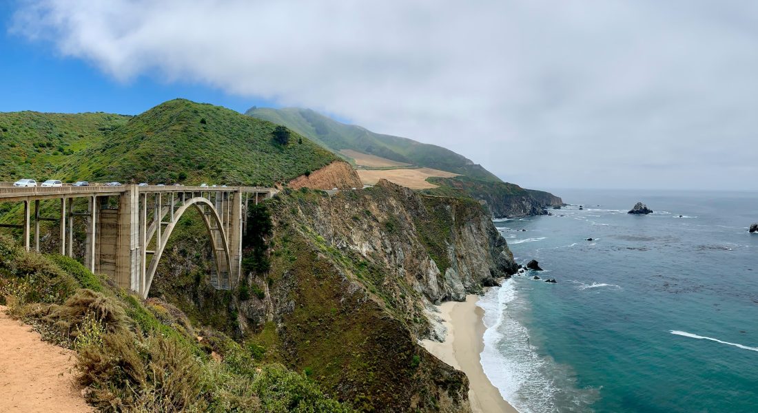
The best spot to photograph the bridge is from the Bixby Creek Bridge Viewpoint on the north side of the bridge, which offers a panoramic view of the bridge and the surrounding landscape. This spot offers a point of view of the bridge from below, and the ocean and cliffs in the background. Visitors can park in the designated parking lot and walk or hike around the bridge to enjoy the view and take photographs.
If you look on Google Maps, you’ll see another spot labeled as the Castle Rock Viewpoint. It is technically the same as this one, but just from the other end of the same parking lot.
2. The Bixby Bridge Vista Point via Old Coast Road
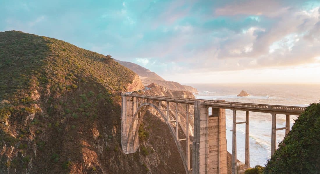
When heading north across the bridge, the entrance to Old Coast Road will be immediately on your right (east side) after exiting the bridge. The road’s entrance is almost directly across from the parking lot, which is on the ocean side of California Highway 1.
This was an old road that travelers would use before the bridge was built in 1932. Parts of Old Coast Road can be driven, but it is most often hiked by visitors looking to get a different vantage point of view of the bridge. The road is narrow, bumpy, rocky, and mostly an unpaved road. Sections are washed out due to heavy rainfall, and there is no through traffic. Any vehicle that goes up Old Coast Road must come back down.
About half a mile up Old Coast Road is the Bixby Bridge Vista Point. However, you don’t have to hike the full amount to get spectacular views of the bridge. Just a short walk will provide breathtaking views of the ocean, the cliffs, and the Bixby Bridge.
3. Brazil Ranch Trail
About half a mile south of the bridge sits the start of the Brazil Ranch Trail. There is a small pull off along Highway 1 that is also the trailhead of this hike. The trail in total is a 5 mile (8 km) out-and-back hike that begins on the other end of the Old Coast Road. The trail is steep, and generally considered moderately challenging. You only need to hike a short distance to get a great view of the Bixby Creek Bridge.
The Ocean View Hike and the Sierra Ridge Hike in the Los Padres National Forest are two other trails that can be accessed from this spot. However, they don’t offer anything much different than what the beginning of the Brazil Ranch Trail does.
4. Hurricane Point
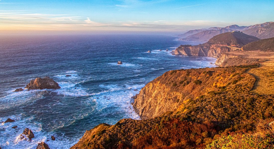
Hurricane Point is located about 1.5 miles south of the Bixby Bridge, and it offers great views of the coast and the Bixby Bridge off in the far distance.
Hurricane Point is a popular spot for visitors looking for panoramic views of the ocean and the coastline. The viewpoint is located at the end of a steep winding road and offers a great view of the rugged coastline, with cliffs, coves, and the ocean. It’s a great spot to take in the beauty of the Big Sur coast.
5. The Southside of the Bixby Bridge
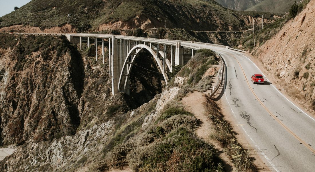
There is a very small pullout just south of the bridge (on the ocean-side). There is room for maybe two vehicles here, which isn’t ideal, but the hike is steep and difficult to get to the top of the bluff. The view is fantastic if you can make it.
6. On the Bixby Creek Bridge
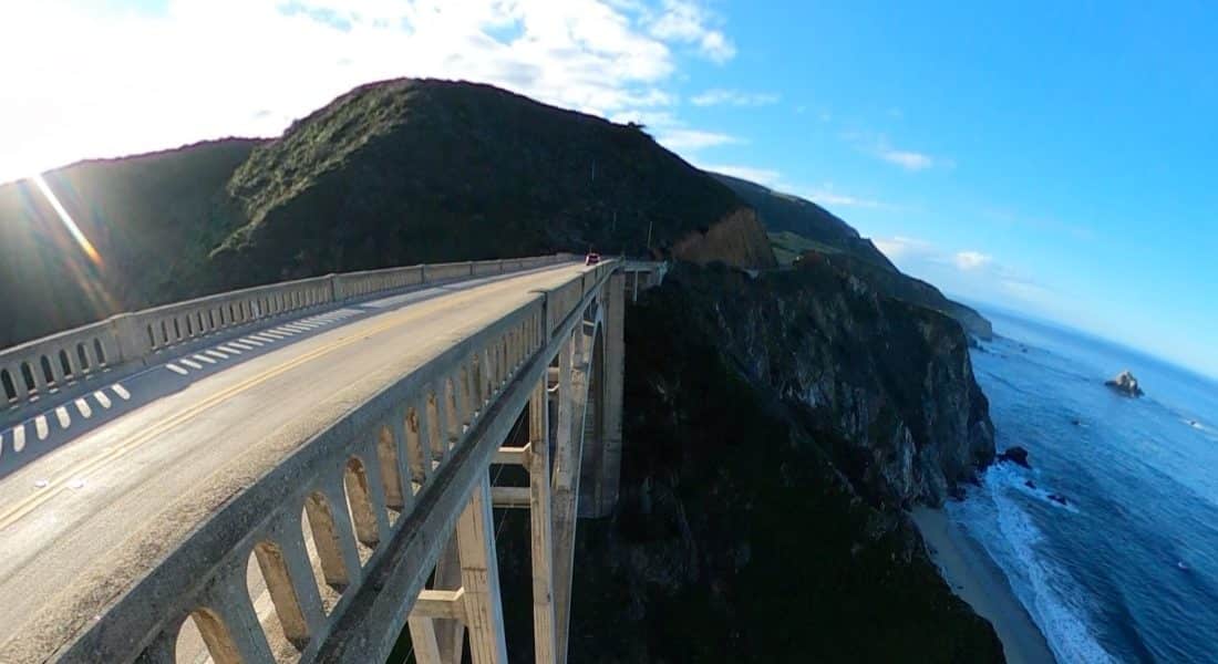
Unfortunately, walking on the bridge is NOT recommended. The bridge does not have a pedestrian walkway (the bridge is only 24 ft wide), and visitors are not allowed to walk or stop their vehicle on the bridge. The bridge is technically for vehicular traffic only, although some daredevils have attempted to get photos on the bridge when there was no traffic coming in either direction. I don’t recommend it.
Other Trails Nearby the Bixby Creek Bridge
In addition to the Bixby Bridge, there are several other great spots and vistas in the area that offer beautiful views and great photo opportunities in Big Sur.
- McWay Falls: The waterfall is located about 8 miles south of the Bixby Bridge and is a popular spot. McWay Falls is an 80 ft waterfall that drops directly into the ocean.
- Pfeiffer Beach: This beach is located about 7 miles south of the Bixby Bridge and is known for its purple sand and rock formations.
- Point Sur Lighthouse: This lighthouse is located about 17 miles south of the Bixby Bridge and offers great views of the coast and the lighthouse itself. The lighthouse is only open for tours on certain days, but it offers great views from the outside.
- Julia Pfeiffer Burns State Park: This park is located about 12 miles south of the Bixby Bridge in the distance and offers great hiking trails and coastal views. The park is home to several waterfalls and great photo opportunities.
- Partington Cove: This spot is located about 18 miles south of the Bixby Bridge and provides access to the historic Partington Cove Tunnel.
